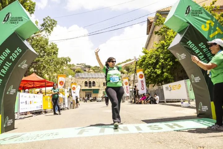
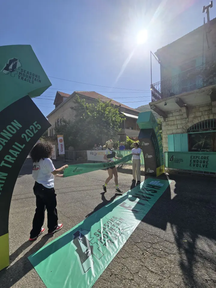
Nestled within the Shouf Biosphere Reserve—Lebanon’s largest protected area and a UNESCO-designated site—this trail race attracts hundreds of endurance athletes eager to traverse rugged terrain, cedar forests, and panoramic vistas. Since its inception, the event has grown into one of the country’s premier ultra-distance challenges, offering 50 km and 75 km options for competitive and recreational runners alike. Organizers emphasize both athletic achievement and environmental stewardship, ensuring minimal ecological impact while showcasing Lebanon’s natural beauty.
Why MaliaTec Chose to Sponsor with WiaTag
As a leading provider of telematics and IoT solutions in the MENA region, MaliaTec has a track record of integrating cutting-edge technology into outdoor events—most notably trail races and cycling tours. For 2025, the 4 Seasons Mountain Trail Race presented an ideal opportunity to demonstrate how GPS-based monitoring can enhance athlete safety, logistical coordination, and spectator engagement.
Key reasons for selecting WiaTag:
- Proven reliability in remote areas. Wialon’s cloud-based infrastructure ensures stable connectivity even in low-signal zones, critical for mountain courses where cellular reception can be patchy.
- User-friendly mobile interface. WiaTag’s smartphone app requires minimal setup, enabling participants to download, log in, and start tracking in under five minutes.
- Scalability. Whether monitoring 100 or 500 runners, WiaTag’s architecture scales without significant incremental cost—ideal for a growing event.
- Comprehensive feature set. From SOS alerts to off-route detection, WiaTag offered a complete toolkit for organizers to maintain oversight across dispersed checkpoints.
Deployment and Technical Setup
Pre-Race Briefing at Coral Headquarters
One week before race day, MaliaTec hosted a technical briefing at Coral Headquarters in Beirut for organizers, medical teams, and course marshals. The agenda included:
- Introduction to WiaTag features. Demonstrations of live location mapping, SOS functions, and geofencing alerts.
- Hands-on tutorial for runners. Step-by-step guidance on downloading the app, creating accounts, and linking to the event’s tracking server.
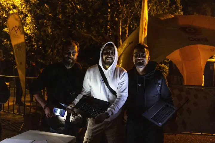
- Control room walkthrough. A mock session showing how MaliaTec staff in the Shouf Reserve control room could monitor runner positions in real time and dispatch assistance.
By the end of the session, all stakeholders—organizers, volunteers, and support staff—understood how to interpret incoming data, trigger emergency protocols, and relay information to on-the-ground field teams.
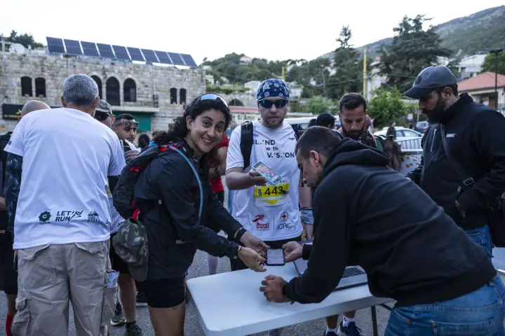
On-Race-Day Configuration
On June 1, volunteers positioned at key checkpoints confirmed that each runner had WiaTag properly configured. For those lacking compatible smartphones, MaliaTec provided a limited number of GPS-enabled mobile hotspots loaned for the race duration. Throughout the competition, all devices transmitted location updates every 30 seconds—even in the most remote gorges—thanks to Wialon’s redundancy in network routing.
Benefits Experienced by Runners and Families
1. Real-Time Location Tracking
Runners on technical sections—especially the steep ascents near the Ain Zhalta and Niha cedar groves—often find themselves out of sight from organizers. With WiaTag, families could follow live maps via a simple web link, seeing exactly where their loved ones stood on the course. This visibility alleviated anxiety for many spectators who would otherwise have to wait at checkpoints for intermittent updates.
2. SOS and Emergency Response
During previous editions of the race, delayed medical response in case of injury or dehydration posed a genuine risk. In 2025, two participants on the 75 km route used WiaTag’s SOS button to signal distress after slipping on a rocky descent. Organizers pinpointed their coordinates to within 10 meters and dispatched a medical team within minutes, likely preventing more serious consequences.
3. Off-Route Notifications
Accidental deviations—particularly at forked trail sections near Al-Barouk cedar reserves—can lead runners off-course, resulting in wasted time or dangerous detours. WiaTag’s geofencing feature alerted organizers when runners deviated more than 50 meters from the marked route. By coordinating via handheld radios, marshals guided these runners back safely, minimizing race disruption.
4. Enhanced Moral Support
Knowing that supporters could track them in real time provided an emotional boost for many participants. Several runners reported feeling a surge of motivation when they saw friends & family cheering them on virtually—an experience not possible in earlier editions without GPS integration.
Advantages for Race Organizers
Improved Resource Allocation
With live telemetry feeding into Wialon’s dashboard, organizers identified potential bottlenecks—such as crowded aid stations at the 25 km mark—and dynamically redirected volunteers to assist. This data-driven approach reduced wait times for refreshments and medical aid.
Post-Race Analytics
Within days of the race, organizers accessed aggregated GPS traces and performance metrics—average pace per segment, time spent in aid stations, and variability due to terrain. This rich dataset will inform future route adjustments, safety improvements, and marketing efforts highlighting challenging segments.
Why This Matters for Lebanon’s Outdoor Community
Lebanese trail running has seen exponential growth in recent years. Events such as the 4 Seasons Mountain Trail not only celebrate athletic achievement but also emphasize environmental awareness. By integrating WiaTag’s capabilities, MaliaTec reinforced the message that technology and nature can coexist to create safer, more inclusive outdoor experiences.
Moreover, the success of real-time tracking in this race sets a precedent for other endurance events across the Middle East. As more organizers recognize the value of GPS telemetry—not only for safety but also for marketing and participant engagement—Lebanon could emerge as a regional hub for high-tech outdoor racing.
Looking Ahead: Sustainable Tech Integration
While WiaTag’s deployment marked a major leap forward, MaliaTec’s broader vision involves:
- Expanding Device Options. In 2026, MaliaTec plans to introduce ruggedized GPS beacons for runners who prefer not to use smartphones.
- Integrating Satellite Connectivity. For sections with zero GSM coverage—particularly above 2,000 meters—satellite modules could ensure uninterrupted tracking.
- Eco-Friendly Battery Solutions. By providing solar-charging stations at key checkpoints, organizers hope to minimize environmental impact while keeping devices powered.
- Community Workshops. MaliaTec intends to host training sessions for local trail clubs, teaching volunteers how to leverage GPS telemetry in rescue scenarios and environmental monitoring (e.g., spotting illegal logging or forest fires).
Each of these steps aligns with MaliaTec’s mission of using IoT and telematics innovations to create safer, more connected outdoor events—while preserving Lebanon’s ecological treasures.
The 2025 4 Seasons Mountain Trail Race demonstrated how strategic tech sponsorship can transform an event’s safety, efficiency, and participant experience. MaliaTec’s sponsorship—centered on WiaTag and Wialon—proved that real-time GPS tracking is no longer optional for competitive trail races; it’s essential.

By offering instant location data, SOS alerts, and off-route detection, WiaTag not only safeguarded runners but also enriched event logistics, timing accuracy, and spectator engagement. As MaliaTec and future partners build on this success, Lebanon’s trail-running community can look forward to even safer, smarter, and more sustainable races—finally uniting the country’s passion for mountain sports with the power of telematics.